data portal
Type of resources
Keywords
Publication year
Topics
-
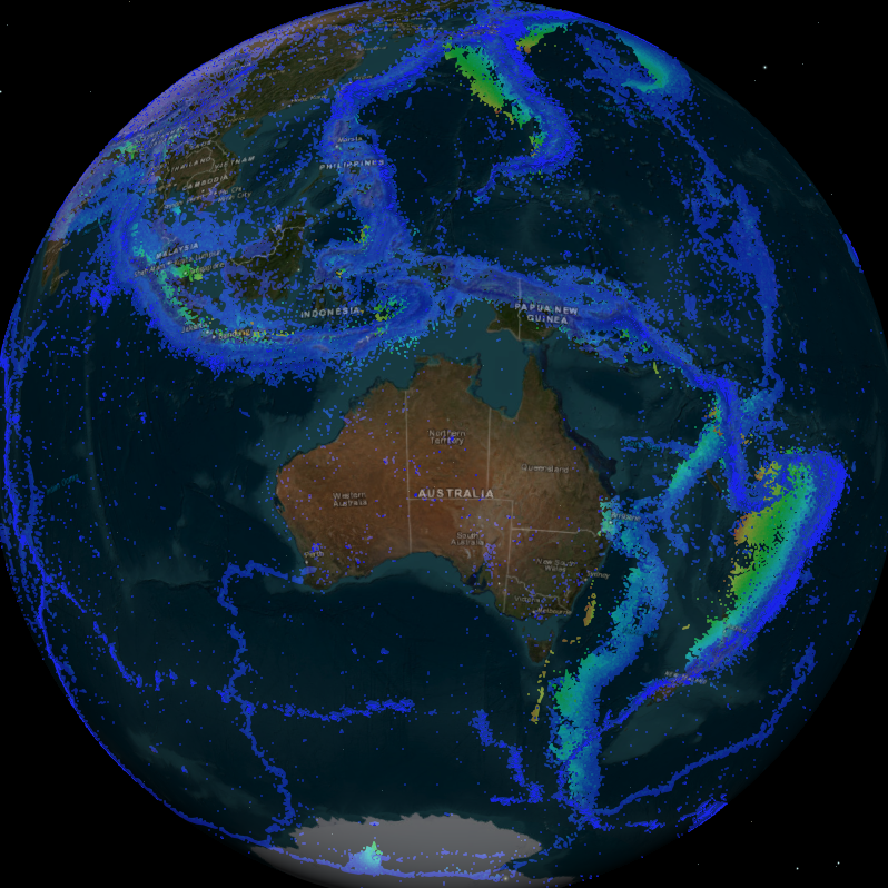
<div>Students can access and analyse real world earthquake data using online portals created by Geoscience Australia (GA) (Geoscience Australia data portal and Earthquakes@GA). The document provides background information for teachers about earthquakes and the online portals, as well as two student inquiry activities. Each activity includes instructions on how to access and use the relevant portal as well as questions that prompt students to find, record, and interpret the data. An Excel table is provided to accompany one of the activities.</div><div><br></div><div>The activities are suitable for use with secondary to senior secondary science and geography students. The topics covered in these activities include: earthquakes, plate tectonics and natural hazards.</div><div><br></div><div>The print version has lines provided for written answers, the accessible version is intended for digital responses. </div>
-
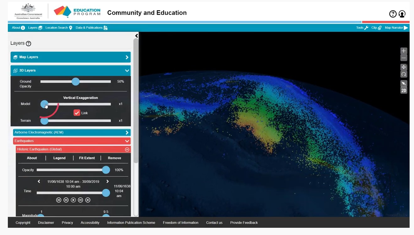
A series of short video clips illustrating how to use the Community and Education Data Portal (https://portal.ga.gov.au/persona/education). The Community and Education data portal is one of many data delivery portals available from Geoscience Australia, giving users access to a wealth of useful data and tools. It has been designed specifically for non-technical users, so that general community members, including educators, can access themed surface and subsurface datasets or images with enhanced capabilities including 3D visualisation, and online analysis tools. The User Guide Video complements the help menu in the portal. The User guide is broken into a series of topics 1. Introduction 2. Toolbar 3. Map layers 4. Multiple Layers 5. Background Layers and Sharing 6. 3D Layers 7. Tools 8. Custom Layers The step by step guides were produced by James Cropper.